Get Involved with CGS!
Block Reference
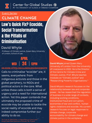
- Please join us for the upcoming lecture "Law's Quick Fix? Ecocide, Social Transformation & the Pitfalls of Criminalisation" by David Whyte (Professor of Climate Justice, Queen Mary University of London, School of Law) taking place on Wednesday, April... Read full story David Whyte, "Law's Quick Fix? Ecocide, Social Transformation & the Pitfalls of Criminalisation"
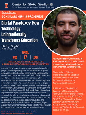
- The recent lecture "Digital Paradoxes: How Technology Unintentionally Transforms Education" by Hany Zayed took place on Wednesday, April 17th at 2 PM in the College of Education Room ED 22 and on ... Read full story Hany Zayed, "Digital Paradoxes: How Technology Unintentionally Transforms Education"
- We join our colleagues in Spanish and Portuguese, in the School of Literatures, Cultures and Linguistics, and from all around the world in sorrow over the death of Professor Elena Delgado. As we mourn her loss, we see her impact at Illinois everywhere we turn. For more on her many accomplishments,... Read full story In Remembrance: Professor Elena Delgado
Center for Global Studies Events

Body